The topography of Virginia was formed through a series of continental collisions of the eons-old shifting of the earth's crustal plates. The vast mountain ranges in Virginia, and the ancestral Appalachian Mountains may have been 20,000 feet high and probably looked more like the present Himalayas than the rounded mountains we see today. The collisions that created tall mountain ranges in Virginia were followed by erosion that etched away those mountains. The eroded sediments piled up in valleys and along the shorelines of the Atlantic Ocean and Gulf Coast
Virginia had no glaciers in the last Ice Age but the forest reflected the cold temperatures and were composed predominantly of spruce and fir trees. As the climate warmed, deciduous forests including oaks, hickory's, maples and beeches, extended up the mountains. The Ice Age megafauna died out as their habitat changed, or perhaps the large animals were so heavily hunted for their meat by Paleo-Indians, that the animal populations could not recover.
The Earth has been in an interglacial period known as the Holocene for more than 11,000 years.
Prior to it's demise, the American Chestnut was the predominant overstory species providing important habitat for wildlife populations (bear, squirrel, turkey, etc.) and was logged here until the mid 1920's. More recently Hemlocks, a predominant species after the Chestnut, are all but dead and gone. Gypsy moths threatened to do the same to the Oaks, but for now, a biological control seems to have the Gypsy moth in check.
Until the 1930's, commercial logging using rail transportation, removed large areas of mature, virgin timber from the mountains. Timber was removed during the 40's, 50's and even into the 60's as the USFS sold individually marked trees (select cuts) to small local family logging operations.
Travel into most of this study area today, other than on foot, is nearly impossible. Historic logging roads into the area, minor disturbances from the start, are practically unrecognizable today. Access to private land in the study area is another thing entirely. Logging on private lands in this area today seems to be primarily by clear-cut. On north facing slopes, revegetation of these clear-cuts is fairly rapid, but on south facing slopes, the soils loose most of the already thin humus layer, and turn into primarily sterile, mineral "desert" soils, where invasive exotic species easily outcompete native vegetation.
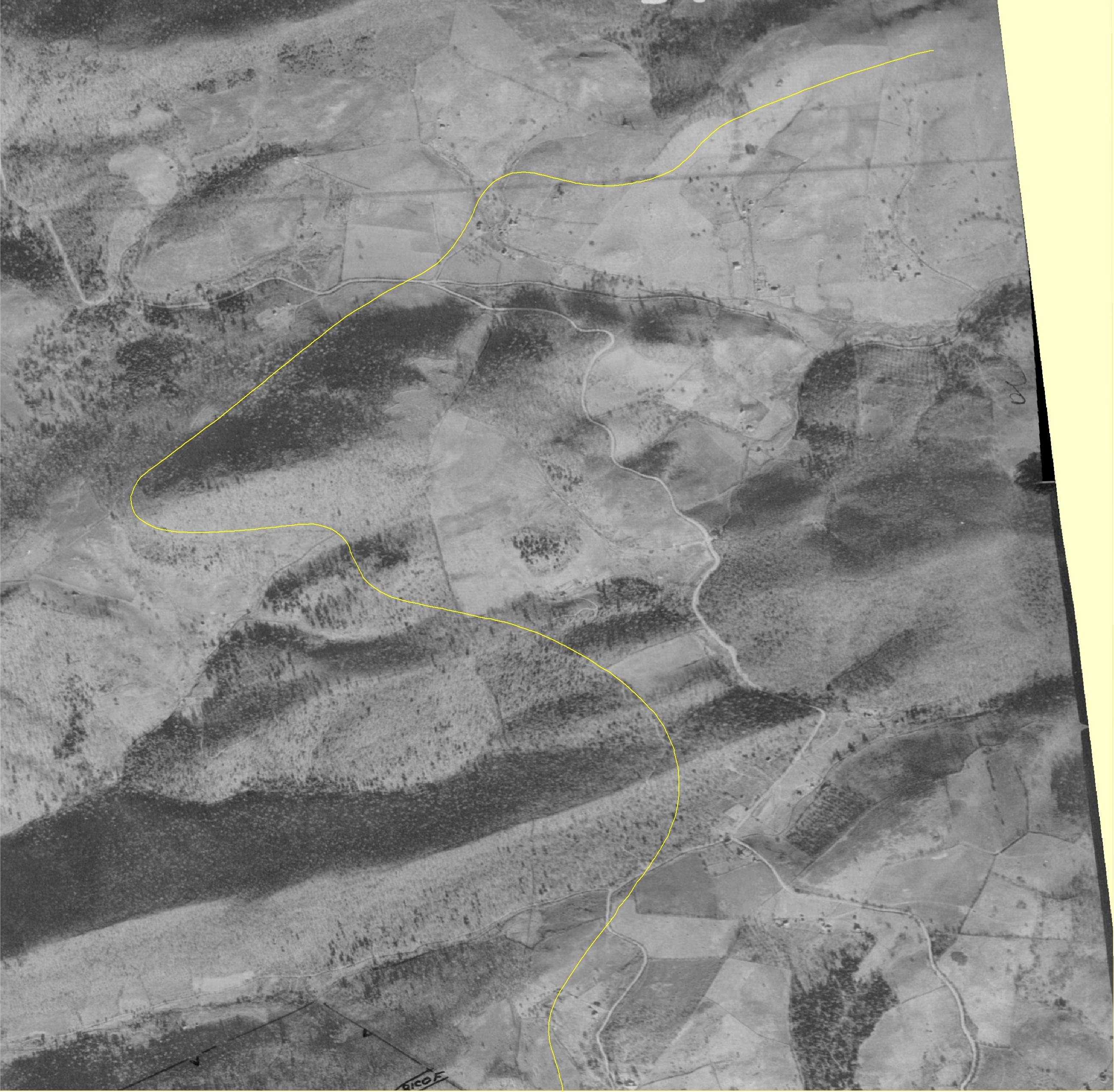
This is a very big file geo-referenced for GIS. First download the following identical file which is much smaller and overlays the roadway visible on modern aerial photos on this sites pages.
This study area has no perienial ponds, lakes, or streams and except for an ocassional seep or small spring, very few vernal pools.
Terrapene carolina carolina
A Relict Population Doomed To Extinction?
